This repository contains the code developed for mapping land cover at a national scale, using Sentinel-2 imagery and weak labels from CORINE land cover data, for aiding the calculation of SDG indicator 15.4.2. The deep model used for training is the Fine-Grained UNET by Stoian et. al, 2019.
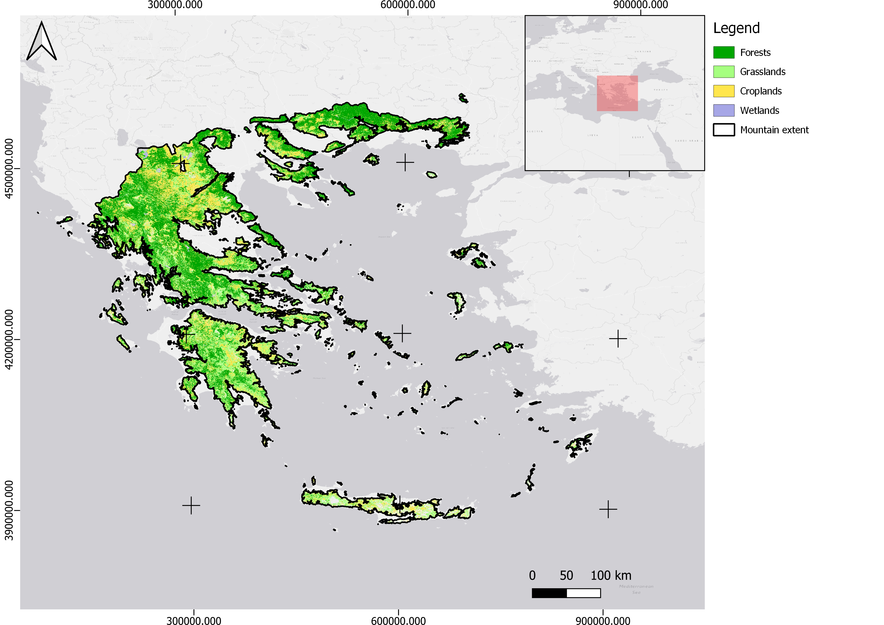 Green coverage as derived from the classification, for the mountainous areas of Greece
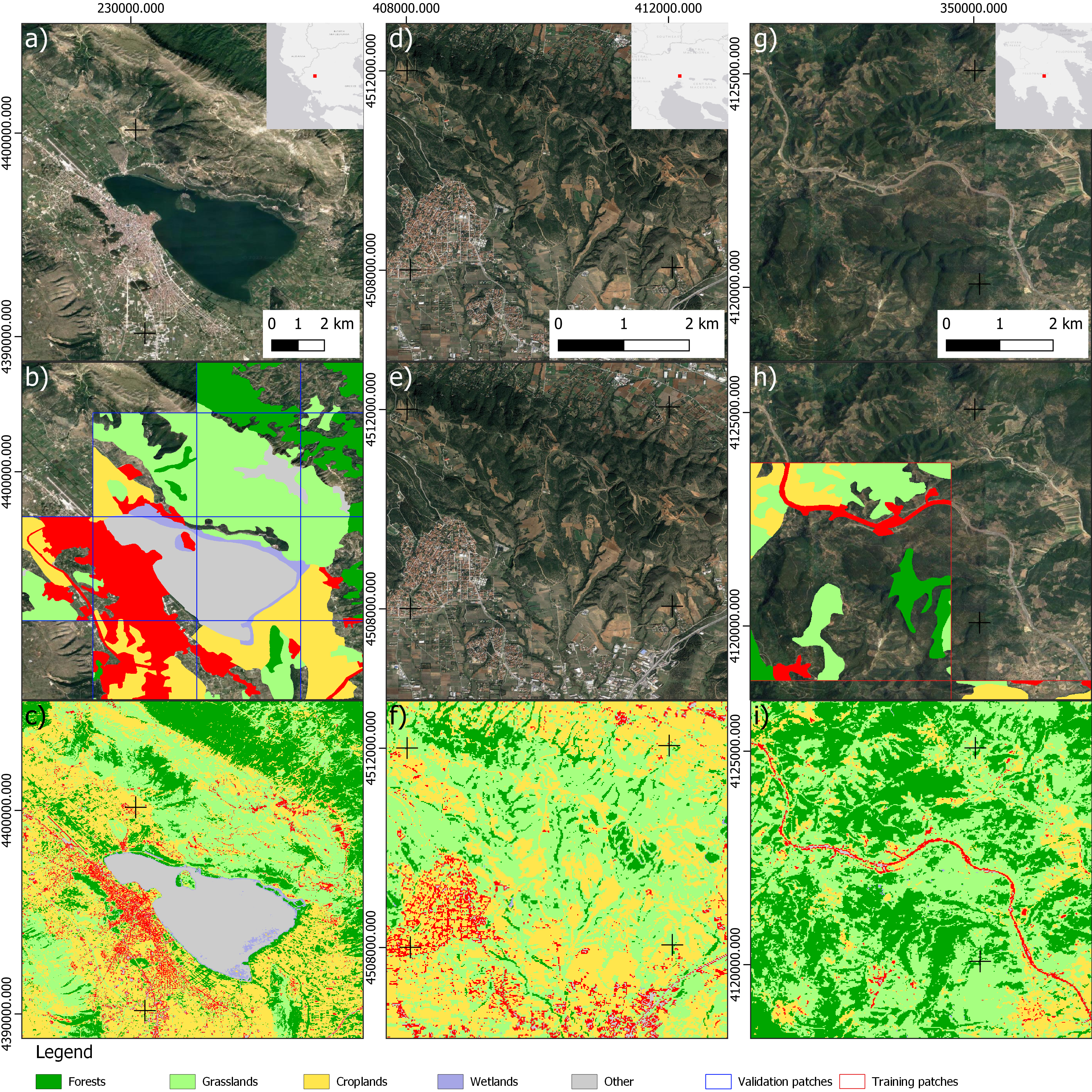 Classification result (c,f,i), compared with the weak labes from the CLC data (b,e,h) and the Google Earth image of each case (a,d,g)
 Classification result (c,f,i), compared to the ESA CCI LC product (b,e,h) and the Google Earth image of each case (a,d,g)
Verde N. Calculation and mapping of sustainable development goal indicators, using open-source earth observation data and cloud computing services. Dissertation. Aristotle University of Thessaloniki; 2023. http://dx.doi.org/10.12681/eadd/56272