Skip to content

Utilizes a simulated iRobot with ROS RTAB mapping graph-based SLAM to map and localize within a home environment

Notifications You must be signed in to change notification settings

WolfeTyler/ROS-RTAB-Mapping-Gazebo

Folders and files

NameName
Last commit message
Last commit date

Latest commit


History

9 Commits


Repository files navigation

Mapping Gazebo Worlds in ROS with RTAB-Map Project

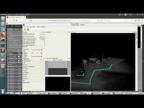
Real-Time Appearance-Based Mapping (RTAB-Map) is a SLAM algorithm supporting Lidar and RGB-D Graph SLAM. RTAB-Map can be used within a ROS stack to map and localize a mobile robot, handheld Kinect, or lidar device by iteratively detecting loop closures through a hypothesis evaluation and acceptance process. To evaluate RTAB-Map's performance several mapped worlds were navigated by a teleop controlled mobile robot with their output 2D and 3D maps compared with the known Gazebo worlds for accuracy.

RTAB-Map_kitchen.gif

Mapping Mars Rover Gazebo World in ROS with RTAB-Map posted on YouTube here:

Youtube Video

About

Utilizes a simulated iRobot with ROS RTAB mapping graph-based SLAM to map and localize within a home environment

Resources

Stars

Watchers

Forks

Releases

No releases published

Packages

No packages published