![]()
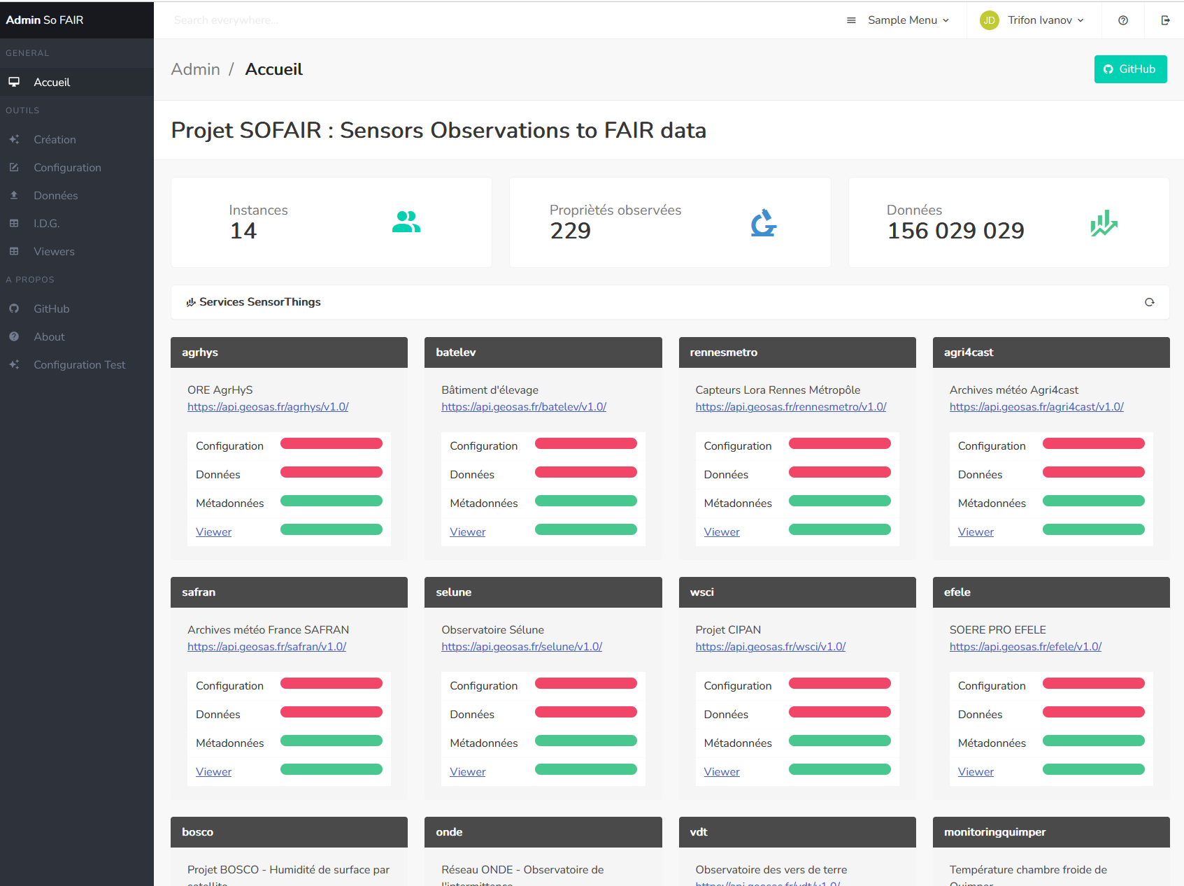
The SOFAIR project is an interoperable middleware designed to promote and develop the OGC SensorThings standard. It takes the form of an OGC API-compliant service integrating various functions to simplify, automate and guide the FAIRisation of temporal data. The processes are :
- Creation of a new SensorThings instance,
- Methods for configuring this instance,
- Various functions to automate or simplify the supply of data to the service,
- Connecting this service to Spatial Data Infrastructures (SDI) in terms of metadata and geographic layers,
- Automatic generation of permalinks to viewers for displaying data from this service in cartographic or time-based portals.
![]()
SOFAIR middleware sofair is at the heart of an ecosystem of services and communicates with various external interoperable modules
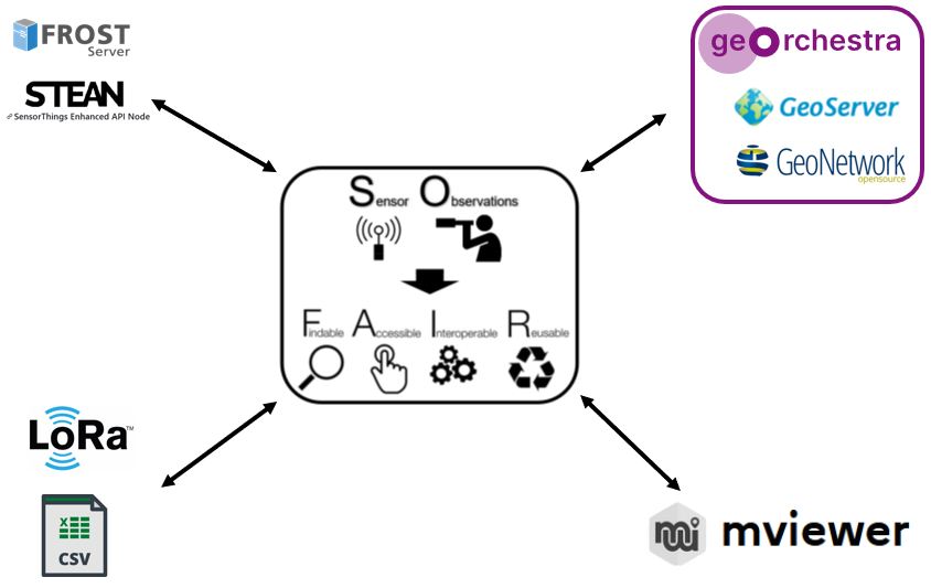
Free, modular and interoperable Spatial Data Infrastructure providing Geoserver ans Geonetwork.
Open source implementation of OGC SensorThings API.
Another open source implementation of OGC SensorThings API based on NodeJS
Mapping portal with SensorThings extension.
Python server implementation of the OGC API suite of standards.
Framework for generating documentation for Web APIs, based on an open source implementation of the OpenAPI specification.
free, open source framework that provides ready-to-use frontend components that you can easily combine to build responsive web interfaces